20091031

A palinologia na TNO

A TNO geobiology é uma entidade que entre outras actividades dinamiza trabalhos no âmbito da geobiologia - bioestratigrafia, bases de dados geobiológicas, reconstruções paleoambientais e paleoclimáticas, reconstruções da vegetação e da paisagem.


http://www.tno.nl/content.cfm?context=markten&content=product&laag1=187&laag2=163&item_id=384


Alguns artigos:


http://www.tno.nl/downloads/Applied%20Palynology3.pdf - Applied palynology


http://www.tno.nl/downloads/359beno3.pdf - The role of palynology


http://www.tno.nl/downloads/Why%20the%20past%20is%20a%20key%20for%20the%20future1.pdf - Why the past is key to the future


http://www.tno.nl/downloads/Publication%20List%20TNO%20Geobiology%20Team6.pdf -lista de publicações


20091025

Para descontrair...frases feitas e ciência

- Write to be cited, not to "get published".


- To take a PhD you need to push yourself to your limits. If it was not hard to take your PhD, you did not do it right.


- It is not the academic degree that gives you value, it's the path that you had to take to get it.


- If you think education is expensive, try ignorance. /Derek Bok


- Knowledge is experience. Everything else is just information. /Albert Einstein

20091023

Peat Materials


Materiais com algum interesse para a paleoecologia, nomeadamente o capítulo 4 - Peatlands and Past Climate Change
Disponível no site - http://www.gecnet.info/index.cfm?&menuid=48


Resultados de bolsas de doutoramento

Já estão disponíveis alguns resultados das candidaturas a bolsas de doutoramento.


http://www.fct.mctes.pt/fctsig/default.asp

20091016

EMBS eCBIO - Eastern Mediterranean-Black Sea- Caspian Corridor Biomes

Um projecto muito interessante sobre palinologia de 2007:


AIM

The aim of the Palynology Group (WG-2) on the UNESCO-sponsored IGCP-521 program is to reconstruct changes in vegetation patterns and fire regimes in the Mediterranean-Black Sea-Caspian Sea Corridor over the past 30,000 years (30,000 yr B.P.).


BACKGROUND
The Mediterranean-Black Sea-Caspian Corridor is a complex region, where the influence of changes in climate is modulated by changes in the extent of the Black and Caspian Sea, and by human exploitation. A relatively high density of sites is required to document changes in vegetation cover in sufficient detail to be able to separate these different influences. There have been many new studies carried out in this region since the BIOME 6000 compilation was completed. WG-2 of the IGCP-521 project will synthesise the data from the region. By combining this synthesis with the existing BIOME 6000 database, and with data being collected in the context of BIOME 6000 daughter projects such as PAINand CiMBIO, we should achieve a good coverage of this key region.

METHODOLOGY
The WG-2 is compiling pollen, plant macrofossil and charcoal data from sites in the region between 28-48°N and 22-62°E. An inventory of sites has been established for each data type. The data are initially entered into workbooks. Information about how to complete the workbooks is given in the accompanying User Guide.
Databases have been created for each data type and data base compilation is being carried out in Bristol. These data will be used to reconstruct changes in vegetation patterns and fire regimes. Workshops are planned to explore the use of biomisation techniques for vegetation reconstruction, and to compare the reconstructions with model-based simulations of changes in vegetation and fire regimes since the Last Glacial Maximum.

INTERNATIONAL SYNERGIES
WG-2 will collaborate with PAINCiMBIO and the Eurasian Macrofossil Working Group to create mutually-compatible data syntheses for the northern extratropics. It will capitalise on the database of charcoal records being created as part of the IGBP Fire Fast Track Initiative. In addition to existing simulations from the Palaeoclimate Modelling Intercomparison Project (PMIPPMIP2), palaeoclimate simulations will be provided by QUEST Theme 2 projects ( PalaeoQUMPQUEST-Deglaciation) and from the NERC Joint Rapid ORMEN project. Simulations with the LPJ-SPITFIRE coupled vegetation-fire model will be run as part of the EU-funded GREENCYCLES and FIRE-PARADOX projects.


Mais informações disponíveis em:

A.A.S.P. NEWSLETTER

A.A.S.P. NEWSLETTER

September 2009, Volume 42, Number 3


http://www.palynology.org/content/nl/nl42-3.pdf


Algumas das notícias da actualidade em palinologia pela A.A.S.P - American Association of Stratigraphic Palynologists

20091013

POLLEN – SO SMALL – SO GREAT: NEW EXHIBITION ON POLLEN AT BERGEN MUSEUM, NORWAY


Welcome to the Micro World: Pollen – so tiny – so great

The new, permanent exhibition "Pollen – so tiny – so great" at the Natural History Collections was opened to the public on Sunday 30 November. We invite you to peer into a fascinating micro world that is otherwise only visible through a microscope.

The new exhibition "Pollen – so tiny – so great" at the Natural History Collections is a knowledge-inspiring and nonetheless beautiful exhibition. You are invited into a fascinating micro world hidden to the naked eye - ordinarily only visible through a microscope.

Pollen grains are extremely small, but in this exhibition they have been magnified and made accessible to us with the help of large 3-dimensional models and images. The exhibition is a new permanent exhibition offered at the Natural History Collections.

Pollen that tell the story about Bryggen (The Wharf)
The pollen grains can be stored for thousands of years if kept in an oxygen-free environment. They build up, layer upon layer, in bogs and at the bottom of lakes thus creating a historical archive the researchers literally can dig (bury) themselves into.
The analysis of pollen from lake sediments and bogs is the single, most important source of knowledge about past vegetation. It tells us something about climate development and human activity. The main features of the development in West Norway’s vegetation from the end of the Ice Age and up to the present are presented in the exhibition. Among the things that were found on Bryggen are pollen grains of exotic plants not common during the Early Middle Ages. This must be a result of importation and can tell us something about when the Bergen population started trade (trading) with Europe.
Professor Knut Fægri (1909-2001) of Bergen Museum and the University of Bergen was one of the pioneers in the development of the pollen analysis during the 1930s and the 1940s. Today, too, the University of Bergen has the largest academic environment in this field in Norway. Associate Professor Kari Loe Hjelle at Bergen Museum has been the expert advisor and driving force for the exhibition.

A Beautiful Exhibition
The exhibition is not only exciting, but also spectacular and beautiful. It is a combination of experience and learning. It consists of large photographs, taken from an electron microscope, illustrations, and models. One of these models is large enough to enter into. The models have been made by the artists Marta Nerhus ( string and paper) and Æsa Bjørk Torsteinsdottir (glass).

The project management has been shared between exhibition architect Turid Mellemstrand and expert advisor Kari Hjelle. Exhibition architect Sonya Reeve has also contributed to the project. The photographs used in the exhibition have been taken by Jan Berge and the adaptation of photographs and illustrations have been carried out by Beate Helle.

Congrès International OFP

16ème Congrès International OFP


Présent et Futur de la Paléobotanique en Europe du Sud-Ouest

9-11 Septembre 2009

NEWSLETTER OF THE INTERNATIONAL FEDERATION OF PALYNOLOGICAL SOCIETIES


NEWSLETTER OF THE INTERNATIONAL FEDERATION OF PALYNOLOGICAL SOCIETIES

20091009

Encontro de Arqueologia da Paisagem e geoarqueologia - HOJE pelas 16h


Importância da palinologia da Lagoa do Saloio na reconstrução paleoecológica da mata do Valado de Frades

Sandra Gomes


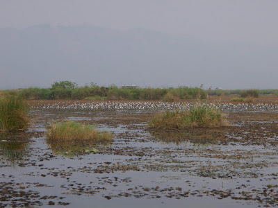
As zonas húmidas como lagoas, turfeiras, pântanos, sapais e outros ecossistemas palustres caracterizam-se pelo seu dinamismo e complexidade do ponto de vista geomorfológico sendo por isso também altamente susceptíveis face a eventuais impactos naturais e/ou antrópicos. A área em estudada, em 2007, a lagoa do Saloio, localizada no concelho da Nazaré, encerra uma história de mudanças ecológicas que se foram sucedendo no decorrer do Holocénico.
Esta “história” evolutiva encontra-se preservada nos sedimentos da lagoa, constituindo a sua análise e posterior interpretação elementos irrefutáveis das alterações ambientais naturais ocorridas quer a nível local quer a nível regional. Mais recentemente, mudanças antrópicas terão causado o seu impacto na área em estudo, sobrepondo-se aos processos naturais. O recurso a diferentes disciplinas viabiliza a possibilidade de vislumbrarmos concertadamente o passado, reconstituindo os acontecimentos patentes nas principais mudanças ecológicas da paisagem. Todavia a palinologia de lagoas e turfeiras, devido à fiabilidade dos seus registos, constitui um dos mais importantes métodos na reconstrução da flora, vegetação e ambientes pretéritos (Faegri e Iversen, 1989).
O Homem, como os demais agentes constituintes da biosfera, é um agente modelador/construtor da paisagem. A sua intervenção reflecte-se de um modo mais ou menos gradativo no território, por vezes irreversivelmente. Assim sendo, o território, pode considerar-se como um artefacto, sendo talhado a cada gesto humano, com repercussões ao nível social (com a repetição do gesto) e ao nível do ecossistema, ao alterá-lo do ponto de vista funcional e espacial no decurso da história e evolução humanas (Mateus et al., 2003).
O concelho da Nazaré apresenta registos de ocupação desde há muito, existindo evidências de ocupação Paleolítica no concelho. No decorrer desta apresentação, procederemos a uma descrição das dinâmicas de ocupação humana na região e seu impacto no ecossistema adjacente, no decorrer do Holocénico recente, assente nos estudos polínicos efectuados. Mais concretamente, desde a colonização dos romanos, cujo impacte na vegetação se revelou intenso, abrangente e diversificado (provavelmente devido à instalação de verdadeiros núcleos urbanos), passando pela Idade Medieval com a atribuição de forais, (o que levou à exploração mais intensificada da região do ponto de vista da silvicultura e da agricultura), cujas evidências estão patentes nas curvas polínicas, até à actualidade
20091006

OIS3 STAGE CONFERENCE


The European continent constitutes one of the finest « natural laboratories » for exploring long term interactions between human spread and climatic change. Central Europe Paleolithic landscape is very well preserved under the thick ammount of aeolian sediments which were deposited during the glacial period. The environmental and climatic record hidden in those deposits offer us the possibility to study long term human relations with climate. The objective of this conference is to explore hominin relations with the environment in Central Europe during Oxygen Isotope Stage 3 (OIS 3 60–24 kyr). We aim to gain better understanding not just of the climatic conditions during this period, but also of how the environment impacted on hominids understanding of themselves and their everyday activities. Answering these questions for the past enriches our ability to better understand human ecology in relation to climate change in the present, and to better understand our human ecological heritage.


http://www.gli.cas.cz/kvarter/OIS3stage/OIS3.html  - mais informações

Blog Action Day 2009


Workshop: Dealing with Neolithic Landscapes

The Neolithic period is associated with the first events whereby people made a considerable and detectable impact on their environment. Ireland has a rich and varied source of palaeoenvironmental data, especially pollen evidence for forest clearance and land use that has been gathered and studied over many decades. Over the last decade in particular, much more evidence than ever before for Neolithic settlement has emerged in the Irish landscape, through developer-led archaeology, whilst an increasing corpus of data, especially in the form of plant macro-remains, attest to the agricultural activities associated with these settlements. Emerging debates are also focusing on the role of environmental change in the development of agriculture. The aim of this seminar is to discuss both the archaeological evidence for Neolithic settlement and economy, and the palaeoecology of landscape, and how the two approaches can be used together to provide a more detailed view of settlement, agriculture, landscape and life in the Neolithic period in Ireland and their associated chronologies. During the seminar, some of the latest results from the INSTAR 2009 funded “Cultivating Societies” project will be discussed, alongside other case studies and overviews from Ireland and Scotland. The afternoon workshop is aimed at archaeologists and environmental archaeologists from the commercial, state and academic sectors who wish to learn more about how past landscapes can be reconstructed, and how evidence for past landscape change is resolved. More experienced environmental archaeologists will have the opportunity to hear about latest modelling approaches using PollandCal. Places on the afternoon workshop are limited to 50 participants, selected on the basis of the application form. The deadline for registration is 5pm on Friday 30th October 2009.

The speakers, in programme order, are;
  • Jessica Smyth, University College Dublin: Missing Links: challenges for Neolithic settlement archaeology.
  • Kenneth Brophy, University of Glasgow: Where were they living? Neolithic houses in lowland Scotland.
  • Meriel McClatchie and Rowan McLaughlin, Queen's University Belfast: Plant macro-fossils from Neolithic Ireland and their implications for understanding early agriculture.
  • Phil Barratt, Queen's University Belfast: Dating the Neolithic landscape: palaeoecological and chronological implications.
  • Graeme Warren, Stephen Davis and Naomi Holmes, University College Dublin: Palaeoclimatology and Archaeology of a Prehistoric Landscape in North Mayo.
  • Jane Bunting, University of Hull: Exploring landscape patterning from pollen records: terrestrial habitats in mid-Holocene Orkney.


20091002

Free Online Access to all SAGE Journals until Oct 31st 2009


SAGE Journals Online


Register now and you will have access to:

- more than 260,000 articles from more than 500 SAGE journals with content available from 1999 
current until October 31, 2009!
- one of the largest and most powerful collections of business, humanities, social sciences, and 
science, technical, and medical content in the world.
- more than 25 research methods journals-from qualitative, quantitative, and mixed methods to 
evaluation.
273 ranked journals including those from 10 of the disciplines SAGE is a market leader in: 
Communication, Criminology & Penology, Special Education, Industrial Relations & 
Labor, Political Science, Mathematical Psychology, Social Issues, Interdisciplinary Social Sciences, 
Sociology, and Urban Studies.*

Identificação de grãos de pólen


Identificar grãos de pólen não é de facto fácil...acrescendo o seu variável estado de conservação. Vários têm sido as tentativas e programas para facilitar a tarefa aos palinólogos. Aqui fica mais um registo!


Pollen Image Management: Using Digital Images to Teach Recognition Skills and Build Reference Collections

Peter Shimeld, Feli Hopf and Stuart Pearson (2001)
Geomorphology and Quaternary Science Research Unit, School of Geosciences, The University of Newcastle, Australia 


http://science.uniserve.edu.au/pubs/callab/vol6/shimeld.html

Identification of Pollen Grains...ajudava um programinho!!!!


Identification of Pollen Grains

A User-friendly Multimedia Identification Software
Objectives

geographical locationAimed at capacity building in the study of pollen grains that have key taxonomic characters, a user-friendly pollen taxa identification method is being developed. In other words, this project highlights the utility of New Tools for "Learning Palynology by click of the mouse" by Taxonomists, promising young Palynologists and Paleo-environmentalists and others (in Paleo- and Neo- Tropics) trained in light microscopic techniques.


Materials and Methods


Sculptural elements on Pollen surfaceChemically fossilised/acetolysed tree pollen taxa of 153 species belonging to 147 genera (Mangroves: 11, Western Ghats: 129 and others: 7) and 63 families (2 monocots and 61 dicots) have been included. The pollen slides are from the pollen-spores slide collection (22,000 specimens in a database furnishing taxonomic information, the richest in Asia) of the Palynology Laboratory of the French Institute of Pondicherry.
A new tool for identification and self-training in plant taxonomy (IDAO by CIRAD) has been adapted to enable Pollen identification by non-sequential choice of characters and without terminology. Vectorised drawings of a composite picture and of about 135 character states of selected tree pollen taxa have been prepared.
Semecarpus aurilculata
Information on the pollen is organized in a database accessed by the identification system. For each taxon, in addition to pollen morphological description, pollen micrographs (1280 Light Microscopic Digital and 105 Scanning Electron Microscopic) with legends, brief information on Ecology and Taxonomy and Distribution data of species and genus are furnished. An illustrated pollen morphological Terminology section and Bibliography are also included.

20091001

Softwares diversos para tratamento de dados paleoecológicos

http://www.ncdc.noaa.gov/paleo/softlib/softlib.html- software gratuito para paleoclimatologia


http://chrono.qub.ac.uk/psimpoll/psimpoll.html - Psimpoll (Bennet)


http://www.pangaea.de/software/ - Panplot


http://www.ncdc.noaa.gov/paleo/tiliafaq.html - Tilia (Grimm)


Pessoalmente utilizei o TILIA apesar de não ser muito intuitivo, e ter um interface pouco amigavel. Todavia, existem vários tutoriais disponíveis na net além de um fórum para esclarecimento de eventuais dúvidas.


http://lists.museum.state.il.us/mailman/options/tilia/ -lista de discussão


Tutoriais


http://geo.arizona.edu/palynology/geos581/tiliaf.html

http://phytolith.missouri.edu/Pages/PhytoPages/Tiliamanual.html

Book of Abstracts ...CIMP Faro'09

Aqui fica o livro de resumos:


http://cima.ualg.pt/eventos/cimpfaro09/CIMP%20Faro'09%20BookABSTRACTS.pdf

II Joint Meeting of Spores/Pollen and Acritrach CIMP Subcommissions- Post Meeting Field Trip


Post Meeting Field Trip

The post meeting field trip will start and finish in Faro. This excursion will highlight important fossiliferous Late Palaeozoic sections:

Day 1: Pedra Ruiva and Murração Sections
The Upper Palaeozoic geology of southwest Algarve is dominated by the Late Devonian Tercenas Formation and the Carrapateira Group of Tournaisian to Bashkirian age. The Pedra Ruiva coastal section exposes superbly the upper part of the Tercenas Formation, consisting of shallow water sandstones. The type section of the Carrapateira Group is located at Murração and Quebradas coastal sections. This group consists of a mud/carbonate succession formed by three formations, from the bottom to the top: Bordalete, Murração and Quebradas. The Bordalete Formation consists of dark shales interbedded by thin bedded siltstones. Miospores and rare macrofauna indicate a middle to late Tournaisian age. The Murração Formation is composed by bioclastic limestones, marly limestones interbedded with shales. Ammonoids fauna and miospores indicate an upper Viséan age. The Quebradas Formation is dominated by black shales with few intercalations of bioclastic limestones. Ammonoids and miospores indicate and Serpukhvian to Bashkirian age. The Quebradas Formation is conformably overlain by turbidites of the Brejeira Formation.
Pedra Ruiva
Departure from Faro, exploring the Pedra Ruiva and Murração sections. Dinner and overnight at Aljezur.


Day 2: Telheiro Coastal Section, Cap San Vicent and Praia da Luz.
Variscan unconformity at Telheiro. Highly folded greywackes and shales of the Brejeira Formation of Moscovian age unconformably overlain by interbedded red sandstones and mudstones of Late Triassic age. Visit the Early Jurassic carbonates and dolomites that form the coastal cliffs around Sagres and Cap São Vincente. At “Praia da Luz” outcrops an early Cretaceous (Aptian) sedimentary succession intruded by a late Cretaceous volcanic plug. The sedimentary succession shows at the base, shallow water sandstones with abundant nerinean fossils. These are followed by red/green mudstones and marls with few intercalations of sandstones and limestones, deposited in lagoonal – brackish environments. At the top of the succession are interbedded limestones and marls deposited in an open marine environment. This succession is intruded by basic igneous rocks of late Cretaceous age.
Variscan unconformity at Telheiro

Departure from Aljezur to Telheiro. Visit the Cap São Vicente and lunch at Sagres. Return to Faro with a stop at Praia da Luz.

Para ter acesso ao guião da visita aqui fica o link- http://cima.ualg.pt/eventos/cimpfaro09/CIMP09_Field_Trip.pdf